
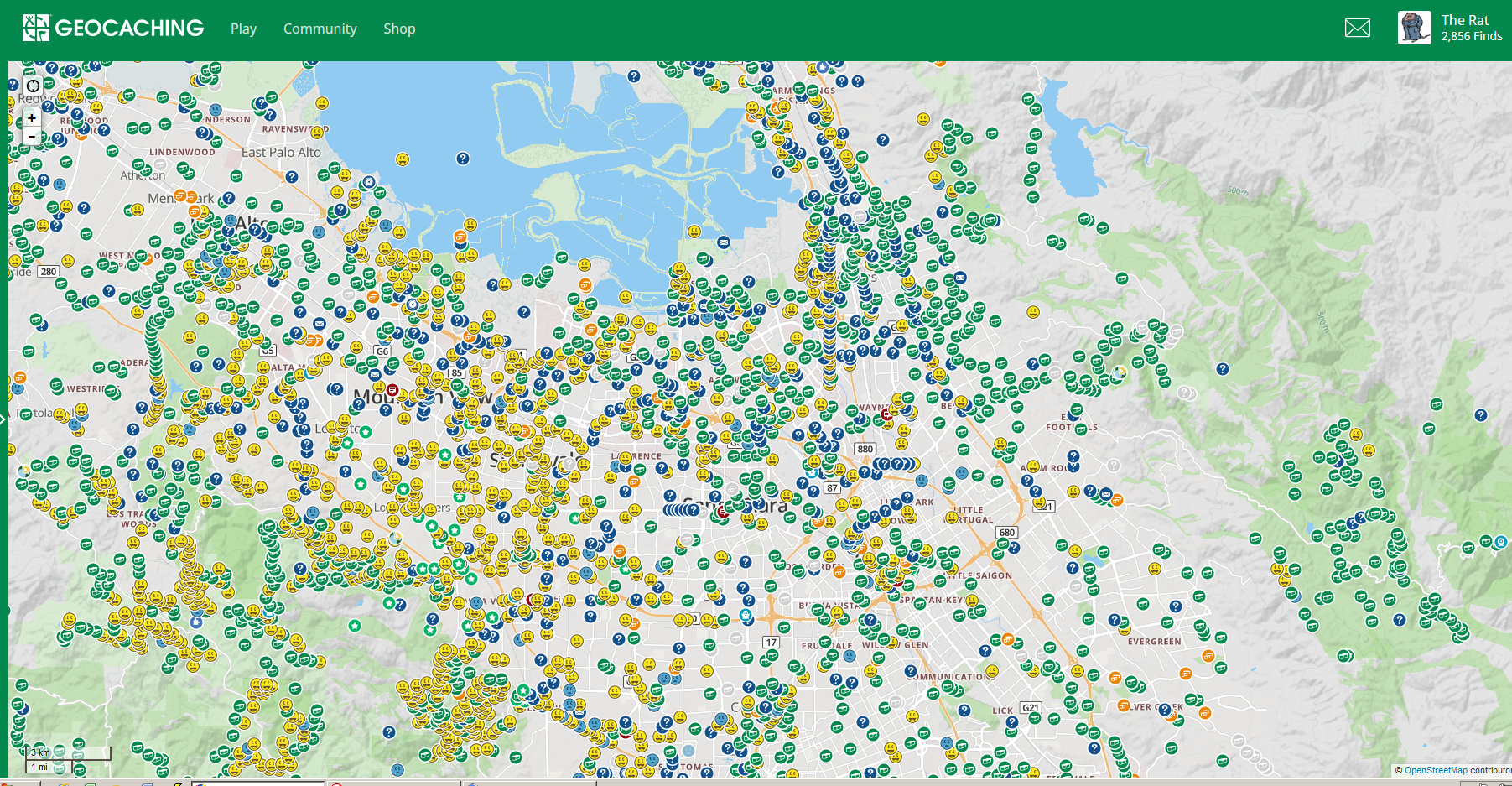
Above is a geocaching map of my local area. For my geocaching friends, this is old hat and doesn’t need explaining, but for those not so addicted and with nothing better to do, I’ll provide a bit of context. Click on the map to enlarge it if you want to understand it better.
This is a map of most of the southern section of the San Francisco Bay Area, the heart of what is now known as Silicon Valley. The big blue part is the southern end of San Francisco Bay itself. The area shown is approximately 20 miles across by 10 miles from top to bottom. Geocachers from other parts of the world may be surprised at the cache density. All the icons represent caches that are still active, i.e. can currently be found. It does not include ones I have found or hidden in the past if they are now archived. The yellow smilies represent caches I have found. The blue ones with the frownie face are ones I looked for but Did Not Find (DNF). The green ones with stars in them are caches I hid. The green ones with the box-like thing in them are regular caches I haven’t found. The blue, orange, and any other colors are caches of other types that I have not found.
A good forensic analyst, one who figures out where serial killers or arsonists live or work, could probably identify where I live from this. If you’re a fan of my Cliff Knowles Mysteries, but don’t know much about geocaching, this map may give you a better idea of the nature and popularity of the sport.